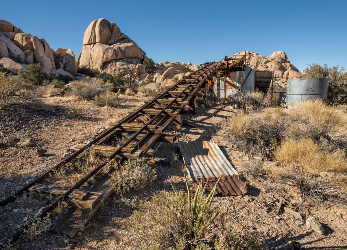
The Wall Street Mill is Joshua Tree National Park’s most intact remaining historic gold stamp mill. Finding a stamp mill like this is rare these days. I’m grateful the NPS has preserved it for future generations to enjoy.
History
Once owned and operated by renowned prospector and rancher Bill Keys, this two-stamp mill was a custom gold mill, which means that he processed gold ore in batches for local mines in the area and took a small percentage from the returns. There was never a mine here.
The mill was initially built over at Pinyon Well (also known as the Pinyon Mountain Mill) in 1891. Keys purchased the stamp mill from New Eldorado Company in 1930 and moved it from Pinyon Well to its current location. He chose this spot because it had a good water source from a hand-dug well beside the mill. The mill includes two stamps made by the Baker Iron Works of Los Angeles, a jaw crusher, and an amalgamation table. A twelve-horsepower Western Gas gasoline engine powered the entire operation.
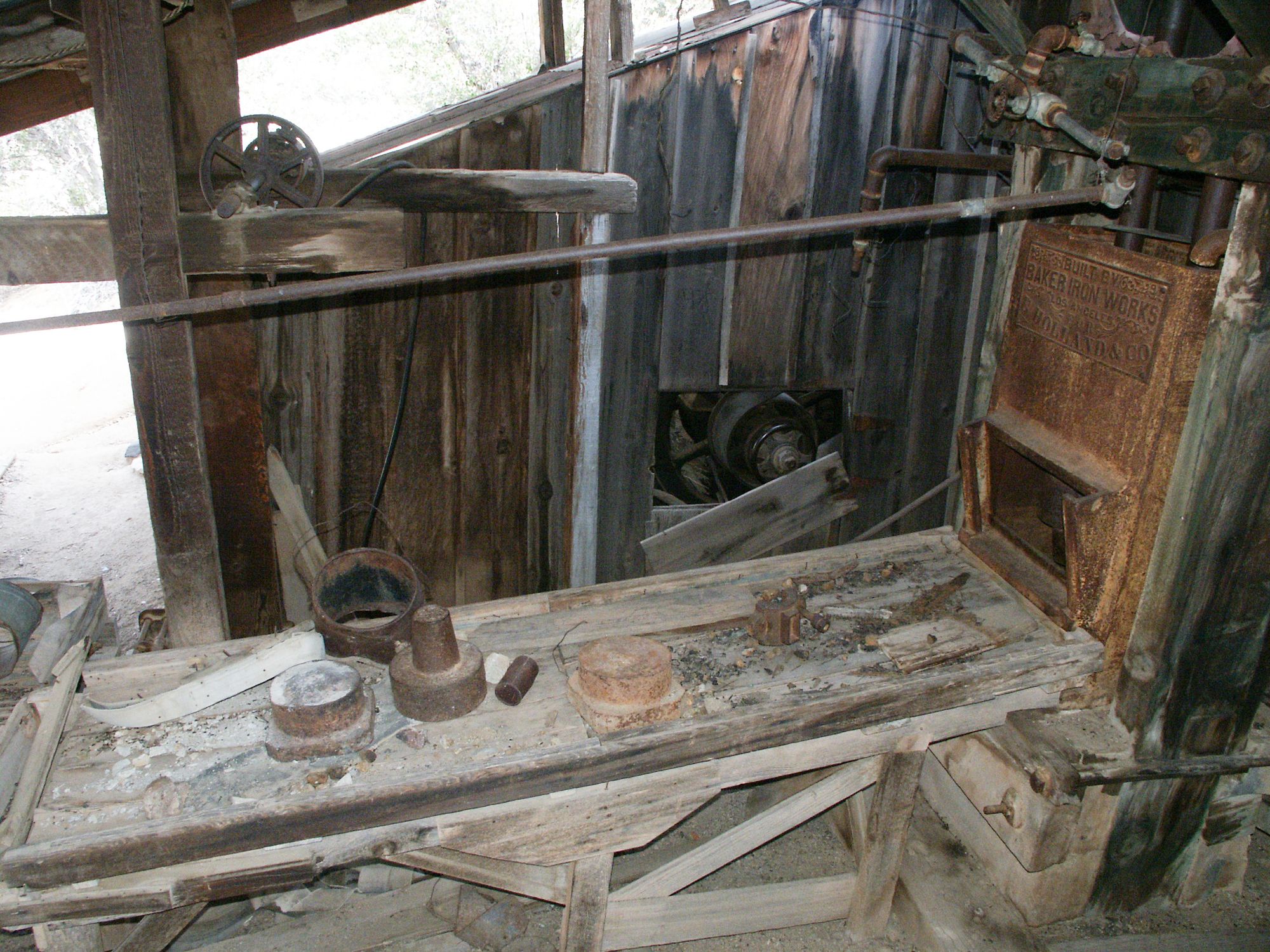
The mill ran intermittently for years until the outbreak of World War II, when all gold mines were closed as non-essential for the war effort. Bill’s son took over and operated it briefly, starting in 1949. Bill ran the mill one last time for about a month in 1966. The National Park Service acquired it from the Keys estate in 1971.
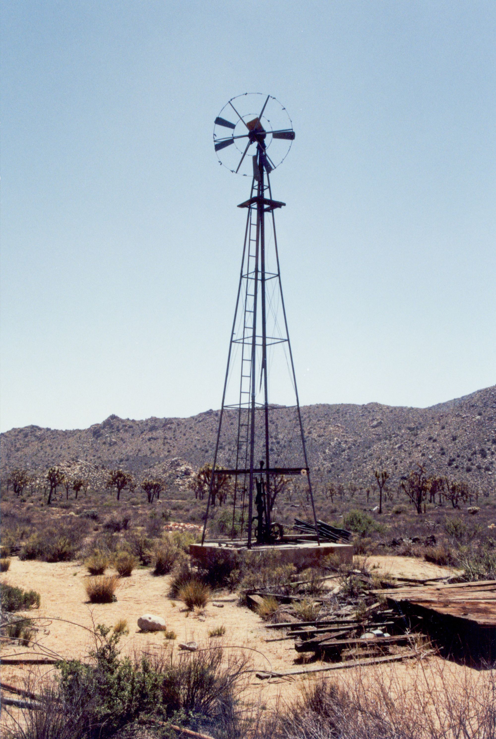
On the way to the mill is a windmill known as the Desert Queen Well, excavated in 1908 by William Morgan. He sunk the well to a depth of 116 feet to reach water for the Desert Queen Mine a few miles off to the east. Surprisingly, it did not deliver water to the Wall Street Mill.
Bill Keys
Bill Keys has quite a long history around the region, and it's more than I could fit in here. See Keys Ranch for more on him. (See the Blackrock Well site where Keys also left his mark).
One of the more famous stories about him involves a gun battle with Worth Bagley. As the story goes, a retired lawman named Bagley moved into a nearby homestead in the late 1930s. An argument developed over access to water at the Wall Street Well next to the mill. After some time, a few of Keys’ cattle were mysteriously shot. Bagley reportedly became obsessed with murdering Keys over access to the water. Finally, in May 1943, they had a confrontation, and Keys shot and killed Bagley at the spot marked along the trail. The current trail marker is a reproduction of the original that Keys carved. It reads: "Here is… Here is where Worth Bagley bit the dust at the hand of W. F. Keys. May 11, 1943."
Keys stood trial and claimed self-defense against Bagley. The jury convicted him of manslaughter and sent him to San Quentin. He spent five years there before being paroled in 1948 (and eventually pardoned in 1956). Once freed, he immediately returned to his family at the ranch and resumed his old life. Keys died in 1969 and is buried on his Desert Queen Ranch (aka Keys Ranch).
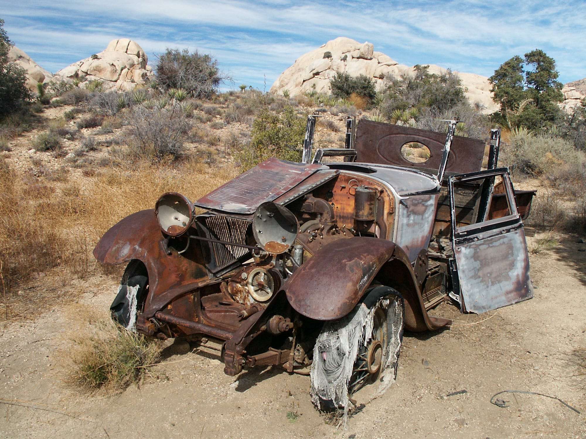
The area around the mill has a few other items left over from Keys’ various side projects. Near the mill, an old 1929 (or 1930) Lincoln Phaeton, which was converted into a truck, sits idly rusting away. "Phaeton" was more of a style than a model in those days.
Directly east of the mill and behind some trees are discards from Bill’s stone carving endeavors. He seemed to enjoy working stone, and his ranch has much more blockwork.
If you are interested in learning more about Bill Keys's history, you should strongly consider a ranger-guided tour of Keys Ranch. Tours are often only available on a seasonal basis and typically cost a small fee. To protect the ranch from vandalism, Keys Ranch and the surrounding area are otherwise completely off-limits to all public entry. As always, please leave everything you find in place. It is illegal to remove anything from a National Park.
Directions
Getting There
The dirt parking lot for the Wall Street Mill is just east of the paved Barker Dam lot. You can also start from the Barker Dam lot. A trail along a sandy wash connects the two, and you can easily combine this hike with Barker Dam or Garrett's Arch.
The Hike
Hike: Easy 1.6 miles out and back, 63 ft gain round trip. 30 minutes
Just past the restroom in the dirt parking lot, the trail follows an old road to the mill. Head northeast toward the windmill. Off to the left are the pink cinder block ruins of the Ohlsone house, an early desert homestead, of which not much remains. A 1920s Dodge truck is nearby.
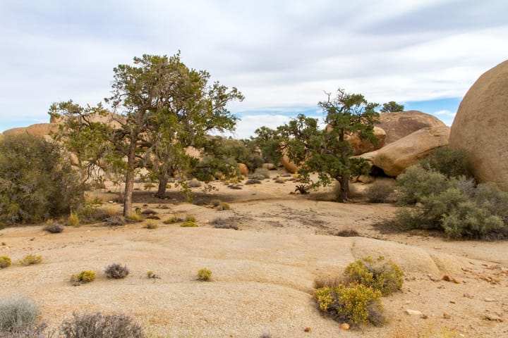
From the Desert Queen Well windmill, the trail turns northward toward the large granite boulders of the Wonderland of Rocks and ends at Joshua Tree’s finest remaining historic gold stamp mill.
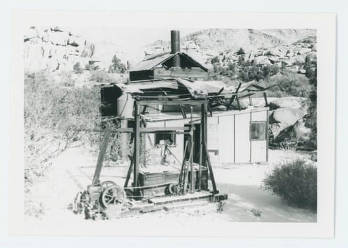
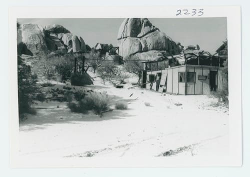
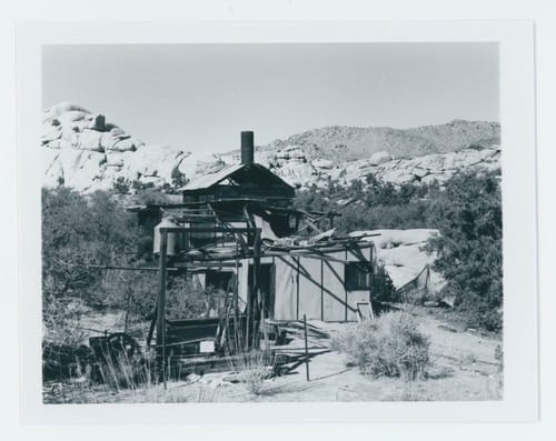
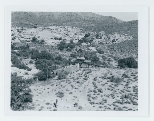
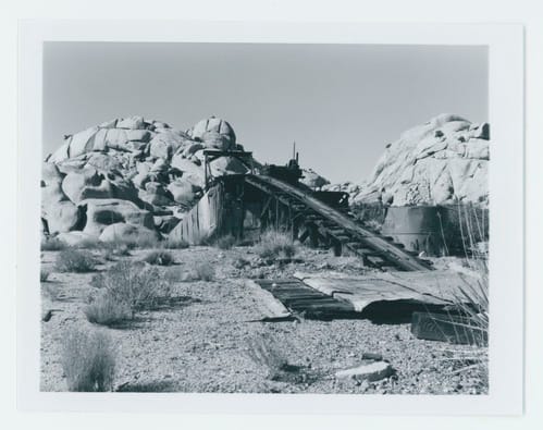
Wall Street Mill in 1975. Photos courtesy of the NPS.
For a bit more info on the Wall Street Mill, see these PDF drawings by the NPS Historic Mining Initiative Recording Project produced by Ruth Connell in the Summer of 1991.
Map
GPS Waypoints
- Wall Street Mill Trailhead: 34.028°, -116.1386°
- Desert Queen Well: 34.0306°, -116.1345°
- Wall Street Mill: 34.0366°, -116.134°
